
While I have never claimed that the location I have flagged as potentially being an end point for MH370 is anything more than my own speculation, and I am certainly not an expert, I am increasingly compelled by the facts I continue to learn about in the region that seemingly give this some support when they are looked at together.
Today I took another look at the ‘seismic’ event that was recorded and analysed by the University of Science and Technology, China. This event took place at 18:55 UTC on 7 March 2014, this is a very reasonable fit with the potential of the plane being there if we ignore the much maligned Inmarsat data. It also fits with the timing of MH370 if a route was taken from Penang to this location across Aceh.
I am aware that the radar covering Aceh was not operational after midnight on this night, both military and civilian. When Indonesia says it did not see this plane it is because they could not have done.
This map was misread by the press when issued.
The red star is the location of the Chinese underwater detector, the circle West of Aceh and encompassing the area 75 miles West of Meulaboh is the location of the seismic event.
The full report can be read here (translation required).
http://seis.ustc.edu.cn/News/201403/t20140314_191123.html
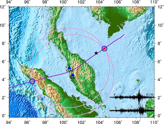
This is not the same location as the seismic event recorded by the Curtin Centre for Marine Science and Technology in Australia.
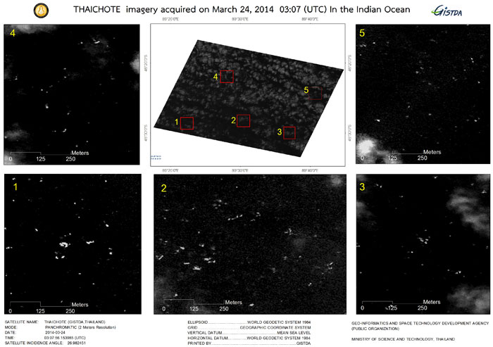
I also noted that images (below) captured by a Thai Satellite are almost identical to the ones I am flagging, albeit the sun being at a different angle due to the fact these were taken of possible debris in the Southern Indian Ocean and the ones I am flagging are only 4 degrees North of the Equator so the sun was almost overhead.
I will keep researching, keep writing and let those reading this blog make up their own minds.
The most important thing is to continue praying for the families of those on this flight.

The seismic event was most likely due to the eruption of Mt Sinabang as mentioned in the factual information safety report for MH370. Here is a quote from the report.
“1.7.2.3 Volcanic Ash Advisory
Volcanic ash advisories issued by Darwin Volcanic Ash Advisory Centre (VACC) on 07
March 2014 at 06:27 and 18:37 UTC for Sinabung (Sumatra, Indonesia) highlighted volcanic
eruption located at 3.10 N 98.23 E (Figure 1.7E above) and volcanic ash plume observed
up to a height of 12,000 ft. (FL120) and the plume was extending toward the west.”
If MH370 flew in this area and into the volcanic ash cloud, then that could quite possibly cause the engines to flame out, as happened with a British Airways Boeing 747 on 24 June 1982 when flying from Kuala Lumpur to Perth, Australia. It would have been extremely unlucky for MH370 to have experienced two inflight emergencies in the one night, but then again, this is whole event is extraordinary and every possibility must be investigated.